victims for over 25 years.
Colorado Roads During Wildfires
As I write this article in mid-August, Colorado burns. This morning, I heard that we are currently up to ten wildfires across the state, with the worst on the Western Slope. In a CPR story this week, a business owner in Glenwood Springs sounded distraught over her business’s ability to stay afloat as tourism takes another hit, while a resident of the town fretted that the Grizzly Creek fire was burning only a mile away. He said that rush hour is bad enough in their only-two-ways-in-and-out little town; what would it be like during a mandatory evacuation?
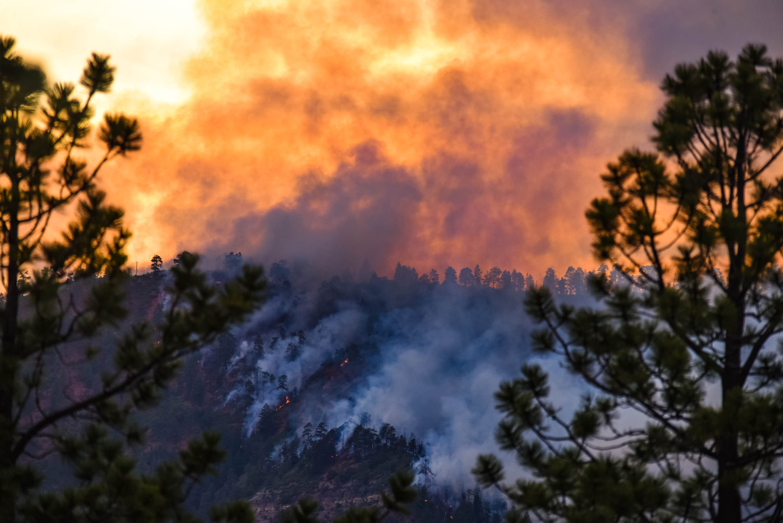
Then there’s the emotional toll that all of us Coloradans face as we see the gorgeous orange sunsets, hearts cracking because we know the beauty tells a tale of massive destruction. Lands we love, animals we cherish, are burning.
Don’t Head to the Mountains Without a Plan
If you are still planning to head to the hills in these dwindling days of summer, I have a few suggestions for assuring your safety, and protecting your mental state.
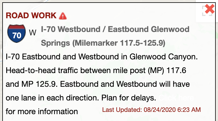
In the days and hours before you even pack the car, I recommend that you check CoTrip.org for road conditions and closures. (We’re used to doing this in snow season, but we need to be doing this during wildfire season, too. Heartbreaking. But I digress.)
This is my go-to website for Colorado road conditions. Not only can you click on the actual route that you’re considering and get a popup with hourly road conditions, but you can view images from cameras that the Colorado Department of Transportation sets up along most major Colorado roads. I just clicked on I-70 along Glenwood Canyon and learned the following:
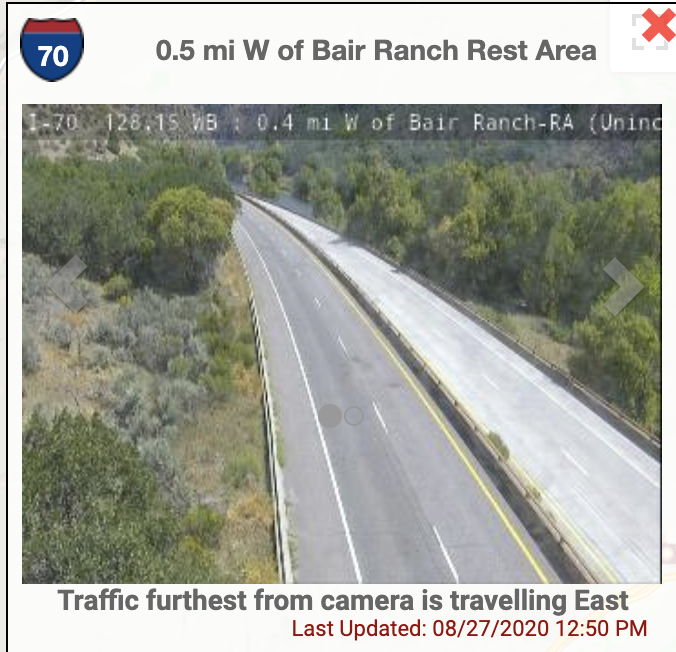
And I clicked on one of many camera icons along the same road and found this image:
At CoTrip, you can also see travel alerts, average road speeds and road work across the state.
Check Air Quality
Given that Denver doesn’t have a fire anywhere near our boundaries and we are all suffering from high ash and smoke levels, I think it would be wise to check the health/respiratory conditions of your destination, as well.
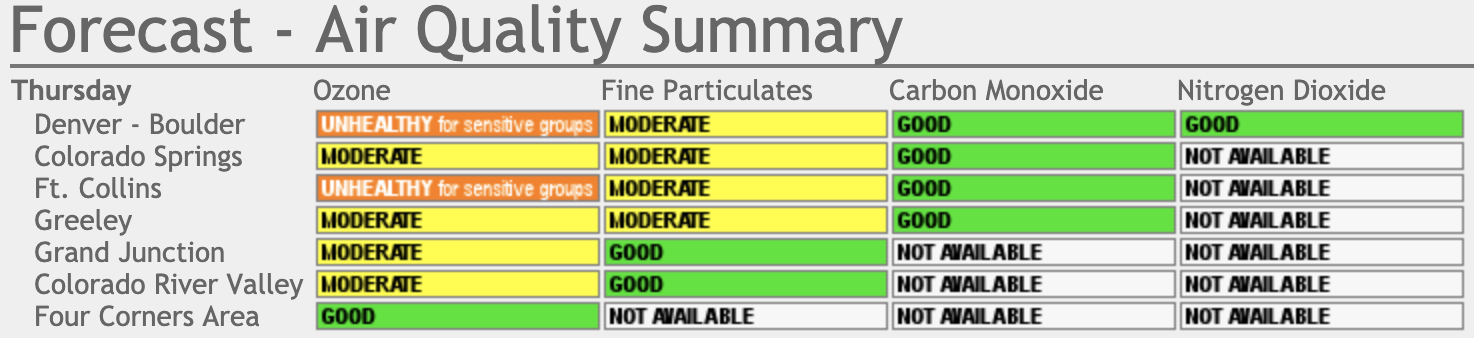
Visit the Colorado Department of Public Health and Environment’s Air Quality website to assess the hazards you may or may not encounter en route or at your final destination.
Today, for example, I found the following information on the Air Quality website, which gives me a good idea of what air quality will look like if we road trip through Colorado this weekend:
Wear a Mask on Road Trips
Sound familiar? I KNOW you are already obeying Colorado mask laws and wearing your mask in public to stop the spread of COVID (right?), but wildfire season can make masks even more critical for at-risk populations. Heck, I don’t have any underlying conditions, but this smoke is wearing me down. The mask really does help.
I hope that the firefighters get these fires under control, and that they all stay safe while doing it. And if you take one last summer road trip, plan ahead using these tips so you can stay safe and have fun!